Showing 417–432 of 1165 results

Lot 149 – Map of New York, London 19th century
Starting price:

Lithograph probably from a drawing by the English architect William Barnard Clarke (1806-1865), inscribed ‘London,…

Lot 150 – Benjamin Rees Davies (1811 – 1869), ‘Brussels’, second half of 19th century
Starting price:

Lithograph from a drawing by the English architect William Barnard Clarke (1806-1865), inscribed at the…

Lot 151 – Palestine et Phoenice’ map, printed in Milan in 1889
Starting price:

Inscription at the bottom ‘Stab.e della Casa Edit.e Dott.r Franc.o Vallardi – Milano – Propriet?…

Lot 152 – ‘Prusse et Pologne’ map, Paris second half of the 18th century
Starting price:

Inscription ‘Imp. Louis Antoine, Rue Des Noyers, 70’ at the bottom, flaws, unframed. Lithograph on…

Lot 153 – Britannia provincia romanorum’ map, 18th century
Starting price:

Engraving on watermarked laid paper, no signature identifying the author. Flawed, unframed. Copper engraving, dimensions…

Lot 154 – Thierry et Barthelemier, ‘Afrique’ France 1853
Starting price:

Engraving made on the studies of the Danish geographer naturalised French Conrad Malte-Brun (Thisted 1775…

Lot 155 – Isaak Tirion (Utrecht 1705 ? Amsterdam 1765), ‘Nuova Carta dell’India’, Amsterdam ca. 1740
Starting price:

Engraving on watermarked laid paper, bearing at bottom left the inscription ‘Nuoua Carta dell’India di…

Lot 156 – Francesco Cepparuli (active 1750-1767), ‘Carta geografica della Dalmazia’, Italy second half of the 18th century
Starting price:

Engraving on watermarked laid paper, bears on the bottom left the signature of the maker…

Lot 157 – Thomas Kitchin (England 1718 ? 1784), ‘Map of the countries on the South Sea from Panama to Guayquil’, London 1777
Starting price:

Engraving from William Robertson’s volume ‘The History of America’, published in London by W. Strahan…

Lot 158 – Herisson – Perrier, French map series ‘Departements et districts’, France 18th century
Starting price:

Seven engravings on laid and partially watermarked paper depicting the following seven French districts: ‘De…

Lot 159 – Giovanni Maria Cassini (Venice 1745 ? Rome 1824), ‘Carta generale dell’Ungheria e della Turchia europea’, Rome 1788
Starting price:

Lot of five partially painted engravings on laid paper depicting: ‘Parte dell’Asia Minore’, ‘Le parti…

Lot 160 – J.B. Ghisi from Andreas Cellarius (Neuhausen ca. 1596 ? Hoorn 1665), Five antique maps, Rome 1774
Starting price:

Series of engravings on watermarked laid paper depicting various countries: ‘Aegyptus et cyrenaica’, ‘Gallia Belgica’,…

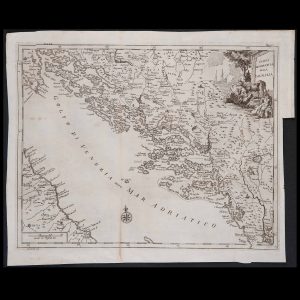
Lot 161 – Merian Matthaus the Elder (Basilea, 1593 – Bad Schwalbach 1650), ‘Carta geografica raffigurante la citt? di Prevesa e parte della Grecia’, Germany first half of the 16th century
Starting price:

Engraving on laid paper, inscription in the cartouche at top right ‘Die stadt Prevesa und…

Lot 162 – Giovanni Battista Piranesi (Mogliano Veneto 1720 ? Rome 1778), Pair of engravings dedicated to Roman antiquities
Starting price:

Engraving with the signature ‘Piranesi F.’ at the bottom, with the inscriptions ‘Topographia Campi Martii…

Lot 163 – Two French maps, late 17th century
Starting price:

Engravings on watermarked laid paper, bearing on cartouches the following inscriptions: ‘Description du royaume de…

Lot 164 – Jacques Ayrouard (active 1730 – 50), Plan du port Hercule, first half of the 18th century
Starting price:

Engraving on laid paper taken from the rare nautical atlas ‘Collection of various plans of…

Previous Next
Close
Test Caption
Test Description goes like this