Showing 433–448 of 1165 results

Lot 165 – Charles Inselin (active 1673-1725) and Nicolas de Fer (Paris 1646 ? 1720), Four French maps, second half of the 17th century
Starting price:

Engravings on watermaked laid paper depicting ‘Toulon – Havre de Grace – Charle Mont –…

Lot 166 – Group of thirteen mixed maps, first half of the 18th century
Starting price:

Series of engravings on watermarked laid paper depicting various countries: ‘Germania antiqua’, ‘Delta del Nilo,…

Lot 167 – J.B. Ghisi from Andreas Cellarius (Neuhausen ca. 1596 ? Hoorn 1665), Four Ancient Maps, Rome 1774
Starting price:

Series of engravings on watermarked laid paper depicting various subjects: ‘Veteris Orbis climata ex strabone’,…

Lot 168 – Giacomo Gastaldi (Villafranca Piemonte ca 1500 ? Venice 1566) ?, Pair of important Ptolemaic maps of Europe and Asia, Italy 16th century
Starting price:

Made on laid paper, the engravings depict Europe and Asia. Flaws present, unframed. Copper engraving,…

Lot 169 – Francesco Sesone (? 1705 – active until 1733), ‘Nuova carta della Contea di Olanda’, Italy 1741
Starting price:

Engraving on watermarked laid paper, signed ‘Franc.o Sesone Sculp.’ at the bottom. Flaws present, unframed.…

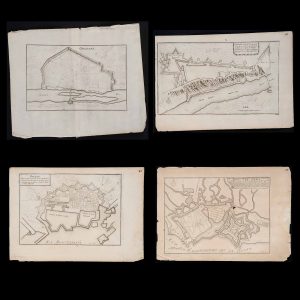
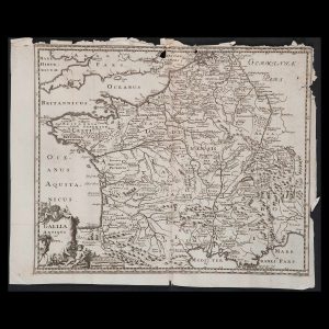
Lot 170 – Giovanni Giacomo De Rossi (1627 ? 1691) and Antonio Barbey (active 1689 – 1703), ‘Il ducato di Bar, di Metz, Tul and Verdun e Il ducato di Lorena’ map, 1689 – 90
Starting price:

Important engraving on laid paper made for Cardinal Francesco Bonvisi according to the studies of…

Lot 171 – Gallia antiqua et nova’ map, Italy early 18th century?
Starting price:

Engraving on watermarked laid paper, flaws present and unframed. Copper engraving, dimensions 11.4×14.1 in.

Lot 172 – Francesco Cepparuli (Active 1750-1767), ‘Carta geografica del Levante Veneto o sia delle isole del Mar Jonio nella Grecia’, Italy ca. 1740
Starting price:

Engraving on watermarked laid paper, on the bottom left the maker’s signature ‘Cepparuli Scul.’, flaws…

Lot 173 – Claes Janszoon Visscher (Amsterdam 1586 ? 1652), ‘De heylige en wytvermaerde stadt Ierusalem, eerst genaemt Salem’ map, Amsterdam 1648
Starting price:

Engraving on laid paper, signed ‘Visscher Excu. 1648’. Flaws present, unframed. Copper engraving, dimensions 13.7×18.1…

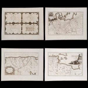
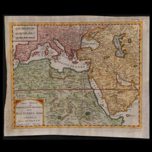
Lot 174 – Isaak Tirion (Utrecht 1705 ? Amsterdam 1765), ‘Carta nuova del dominio e stati del Turco, stiuati nell’Europa e nell’Asia ed Aemerica’, Amsterdam 1742
Starting price:

Engraving on watermarked laid paper based on the opera ‘Atlante novissimo che contiene tutte le…

Lot 175 – Philipp Cl?ver (Danzica 1580 ? Leida 1622) and Petrus Bertius (Beveren 1565 ? Paris 1629), ‘Sophorum Regnum’, first half of the 17th century
Starting price:

Engraving on laid and partly painted paper; flaws present, unframed. Copper engraving, dimensions 5.9×7.4 in.

Lot 176 – Pieter Van der Keer?(Gand?1571????1646), ‘Creta’, Flanders first half of the 17th century
Starting price:

Engraving on watermarked laid paper, in the cartouche on the upper right the inscription ‘Creta…

Lot 177 – Giuliano Zuliani (? 1730 – Venice 1814), ‘L’America divisa nei suoi principali Stati’, Italy 1776
Starting price:

Engraving on painted watermarked laid paper based on the volume ‘Atlante novissimo, illustrato ed accresciuto…

Lot 178 – Painted map of the town of Middelburgum, second half of the 17th century
Starting price:

Watercoloured engraving on laid paper and decorated with the coat of arms of the city…

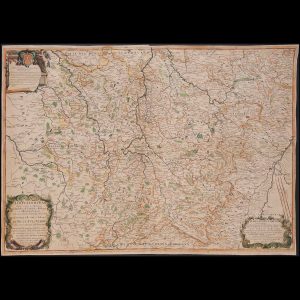
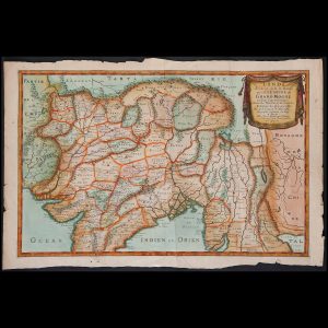
Lot 179 – Nicolas Sanson (Abbeville 1600 ? Paris 1667) and Pierre-Jean Mariette (Paris 1694 ? 1774), ‘L’Inde de?? e dela le Gange, ou est L’empre du Grand Mogol’, France 1654
Starting price:

Engraving on watermarked laid paper, finely watercoloured. It bears in the cartouche the signatures of…

Lot 180 – Isaak Tirion (Utrecht 1705 ? Amsterdam 1765), ‘Nuova carta di Irak Arabi,Kurdistan, Diarbek, Turcomannia, Siria e Palestina’, Amsterdam 1742
Starting price:

Engraving on watermarked laid paper taken from the volume ‘Atlante novissimo che contiene tutte le…

Previous Next
Close
Test Caption
Test Description goes like this