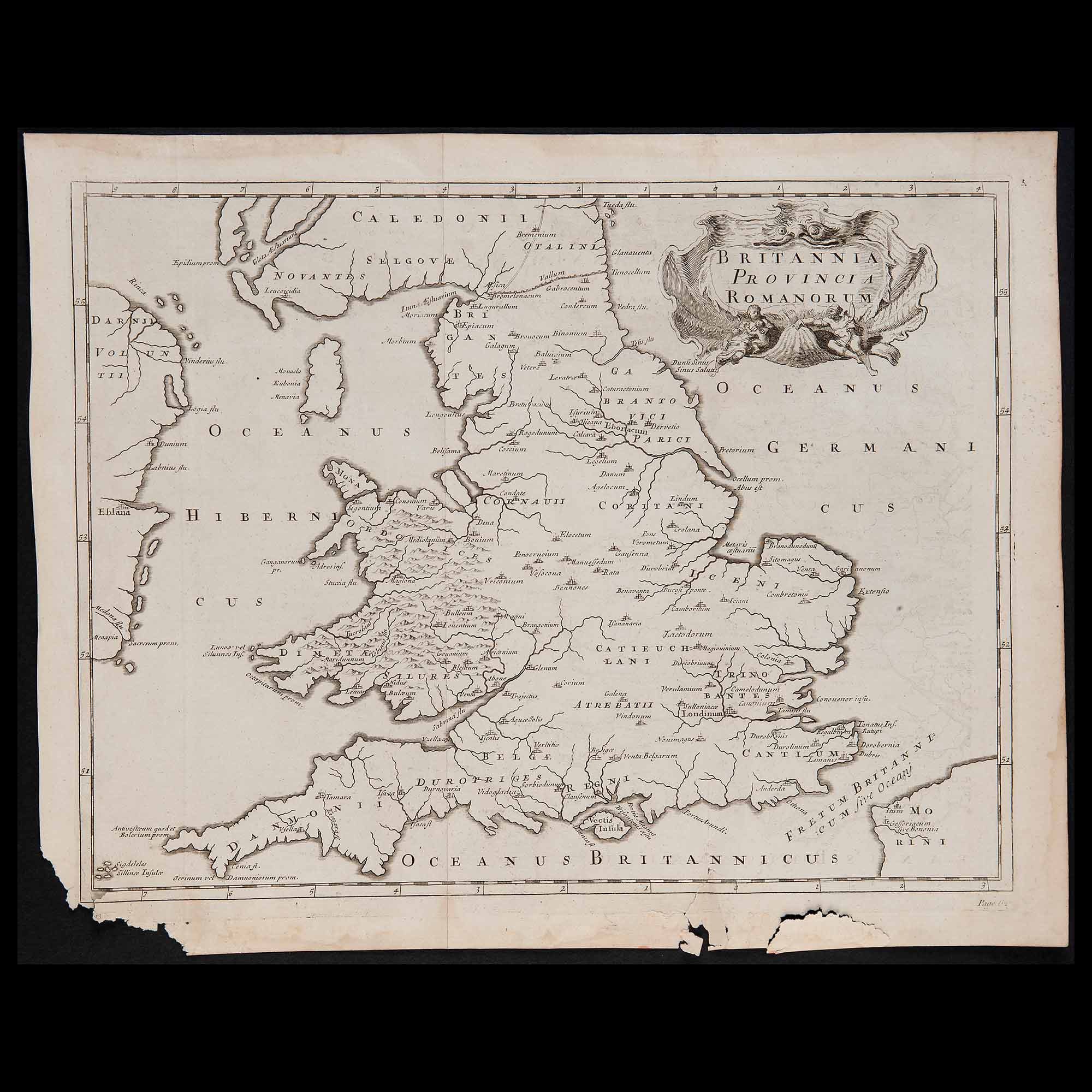
• Background Image

    Lot 153 – Britannia provincia romanorum’ map, 18th century

    June 20, 2022

Lot 153 – Britannia provincia romanorum’ map, 18th century

Starting price:


Lot 153 – Britannia provincia romanorum’ map, 18th century

Current Auction: N. 17 
AMERICAN DESIGN & EUROPEAN GRAPHICS
( Rome, July 06-07, 2022 - 5:00 P.M. CEST )

Explore this Auction

Description

Engraving on watermarked laid paper, no signature identifying the author. Flawed, unframed. Copper engraving, dimensions 16.1×20.2 in.

Reviews

There are no reviews yet.

Be the first to review “Lot 153 – Britannia provincia romanorum’ map, 18th century”

Your email address will not be published. Required fields are marked *

ABSENTEE BID FORM


    *Required fields

    Lot 166 – Group of thirteen mixed maps, first half of the 18th century
    Starting price:

    Series of engravings on watermarked laid paper depicting various countries: ‘Germania antiqua’, ‘Delta del Nilo,…

    Lot 165 – Charles Inselin (active 1673-1725) and Nicolas de Fer (Paris 1646 ? 1720), Four French maps, second half of the 17th century
    Starting price:

    Engravings on watermaked laid paper depicting ‘Toulon – Havre de Grace – Charle Mont –…

    Previous Next
    Close
    Test Caption
    Test Description goes like this