Home / AUCTION 17 session2
Showing 1–16 of 156 results
No reserve
Map taken from Jean-Baptiste Bourguignon d’Anville (Paris 1697 – 1782), signed ‘G. Caniani inc.’, flaws…
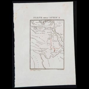
At the bottom is the inscription ‘Viaggio di Bruce – Frat. Bonatti inc.’, flaws present,…
Flawed, without signatures or identification; unframed. Copper engraving, dimensions 8.8×11.6 in.
Lithograph probably from a drawing by the English architect William Barnard Clarke (1806-1865), inscribed ‘London,…
Lithograph from a drawing by the English architect William Barnard Clarke (1806-1865), inscribed at the…
Inscription at the bottom ‘Stab.e della Casa Edit.e Dott.r Franc.o Vallardi – Milano – Propriet?…
Inscription ‘Imp. Louis Antoine, Rue Des Noyers, 70’ at the bottom, flaws, unframed. Lithograph on…
Engraving on watermarked laid paper, no signature identifying the author. Flawed, unframed. Copper engraving, dimensions…
Engraving made on the studies of the Danish geographer naturalised French Conrad Malte-Brun (Thisted 1775…
Engraving on watermarked laid paper, bearing at bottom left the inscription ‘Nuoua Carta dell’India di…
Engraving on watermarked laid paper, bears on the bottom left the signature of the maker…
Engraving from William Robertson’s volume ‘The History of America’, published in London by W. Strahan…
Seven engravings on laid and partially watermarked paper depicting the following seven French districts: ‘De…
Lot of five partially painted engravings on laid paper depicting: ‘Parte dell’Asia Minore’, ‘Le parti…
Series of engravings on watermarked laid paper depicting various countries: ‘Aegyptus et cyrenaica’, ‘Gallia Belgica’,…
A payment method is required to participate in this auction
Telearte Auctions